Our younger readers will not recognise the reference today to the two arches standing in the roadway next to Sawley Abbey. Regrettably the arches fell victim to various careless vehicle drivers who were constantly colliding with them and were demolished to make them safe.
Charlie’s route today is one of my favourites but if cycling I would reverse the route and travel from Malham to Settle, it is much easier on the legs.
Sunday, March 1 Malham and Settle
Another ‘star’ run! Last night I journeyed to Barton Bridge, where I met Tom, and we returned to Bolton to spend the night at our place, prior to an early start for Yorkshire.
We got up at 6am this morning, and at 7.30 started. The morning was cold and very misty, but we hailed this as a prelude to another sunny Sunday. As we had beforehand decided to ‘crash through’ Darwen and Blackburn as the shortest way to Whalley, we started the gradual climb via Dunscar to the summit of Edgeworth moors, nearly 1,000ft above sea level. From this vantage point we got a surprisingly picturesque view of the snow-clad ridge of Winter Hill across the Belmont road. Came the rough tumble down to Darwen, where we noticed a strange coincidence pertaining to street names. ‘Police Street’, then just beneath ‘To Model Lodging Houses’! A still rougher tumble landed us in Blackburn at 8.45. The streets were then soon put away behind, and we came to Wilpshire, from where the road runs above the Ribble Valley.
The usually fascinating views were shrouded, for the mist yet showed no signs of lifting. Langho, then at 9.30 we were rushing down into Whalley, with the ruins of the famous Abbey below us. The River Calder crosses beneath the road in the village, on its way to meet the River Ribble, and forms a rather picturesque scene as it chatters over its stony bed with the trees bending over, and green banks lining the river. Only a moment did we stop, for we had a long run to lunch, and a hilly one too. The road to Clitheroe is paved mostly and tilts a little, so that we found it something of a drag, which was relieved, however, by the appearance of Pendle Hill above the mist. The black, moorland summit, 1,831ft was wonderfully changed by the snow, which clung to the slopes and left the rocks black and bare.
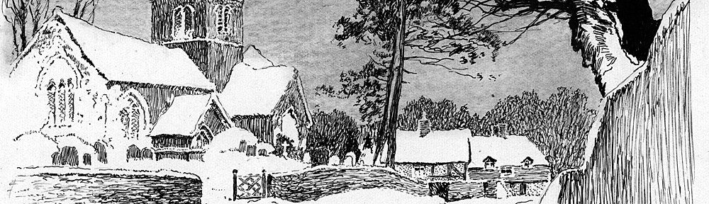
We walked the steep main street in Clitheroe, above which the Castle stands, its ruined keep and walls frowning on the town. Cotton factories never tend to beautify a town, and Clitheroe is no exception, so we hastened out of it on the Skipton road. As far as Chatburn the outlook was even sordid, but immediately after the village the road changes and becomes more like a winding lane to Sawley, with the company of the rapidly lessening River Ribble. Here we left the Skipton road, and rode between the two ancient arches which stand at the roadside, the scanty remains of Sawley Abbey, and crossed the river by a high, double span bridge.
The surface degenerated into a stony, river-ish appearance, and climbed very easily for two miles, where we turned towards Wigglesworth. We had a snack by the wayside a little further on, whilst the musical bell of Bolton by Bowland church could be heard calling the inhabitants to church. The following run across Forest Becks and up onto Town Moor was very undulating, but beautiful and exhilarating, and on the summit, above Wigglesworth, we obtained some wonderful views of the hills around. Happily, the mist had cleared.
The sun came out, and in the distance gleamed lines of rugged, snow-capped escarpments. All around us, the fells glistened in their white mantles. The scene was inspiring – we wanted to get there, we wanted to stand on these limestone heights, we wanted to get up into the snow. The road jumped up or swerved downhill, the while we increased our pace and rushed through tiny little Wigglesworth to Rathmell, where we found ourselves in Ribblesdale and nearer to the heights. Settle lay before us, and beyond, a high, upland valley, closely hemmed in by snowy fells. What a long time it took us to reach our goal and get to the hills!
Ribblesdale, here, is a flat, marshy valley, and in itself, uninteresting – but the beyond! At length we climbed into the town of Settle, and reached the quaint Market Square, where that cyclist’s haven, the ‘Naked Man’, had our lunch ready in a jiffy. Behind the town, or market square, a great jagged rock towered, Castleberg it is called, and on its summit earthworks can be seen, but so completely has the castle been obliterated that hardly a stone remains. Here we decided to make the circuit of Malham Tarn and Cove, and, perhaps, Gordale Scar.
Leaving Settle on the Ingleton road, we came to the Ribble, but did not cross over, turning right by the river bank towards Langcliffe, and from that stone moorland village, joined a third rate road that started to climb in real earnest. The gradient and surface soon reduced us to perspiration, though the day was cold and we were walking. In half a mile we climbed from 600 ft to 1,200 ft. On the summit, the limestone outcrop was peculiarly formed, reminding me of the Giants Causeway in Ireland, and the region of Fingal’s Cave in Scotland, though the hexagons were not nearly so perfectly formed here.
In one place we rode through a little pass with limestone walls on each side, then we emerged on to the open moors. Snow everywhere, the distant – and near – hillsides heavily clad in white, whilst the moors on which we stood were patched in black slopes and white, glistening snow. So deep was it at the roadside that we stuck our bikes in it! The road was clear, but in a filthy, oozy condition. The mountain views were fine, but much lower down in Ribblesdale, a haze still hung over the lowlands, and only a short length of river and brown, winding roads were to be seen. Came a steep drop to Cowside Beck, then up again for about a mile with magnificent fell scenery about us. Then Malham Tarn came into view, and the road by Capon Hall became rideable. Malham Tarn is a large sheet of water, a kind of ‘oasis’, high up on the moors. On the north side is a towered residence, Malham Tarn House, backed by woods and a limestone cliff, and the height is about 1,350 ft.
Charles Kingsley wrote his famous novel here, ‘Water Babies’, and this is a good point to see the ‘Craven Fault’, a great geological dislocation which, beginning near Kirkby Lonsdale gives almost continual evidence of its existence all the way to Threshfield in Wharfedale, a distance of 22 miles.
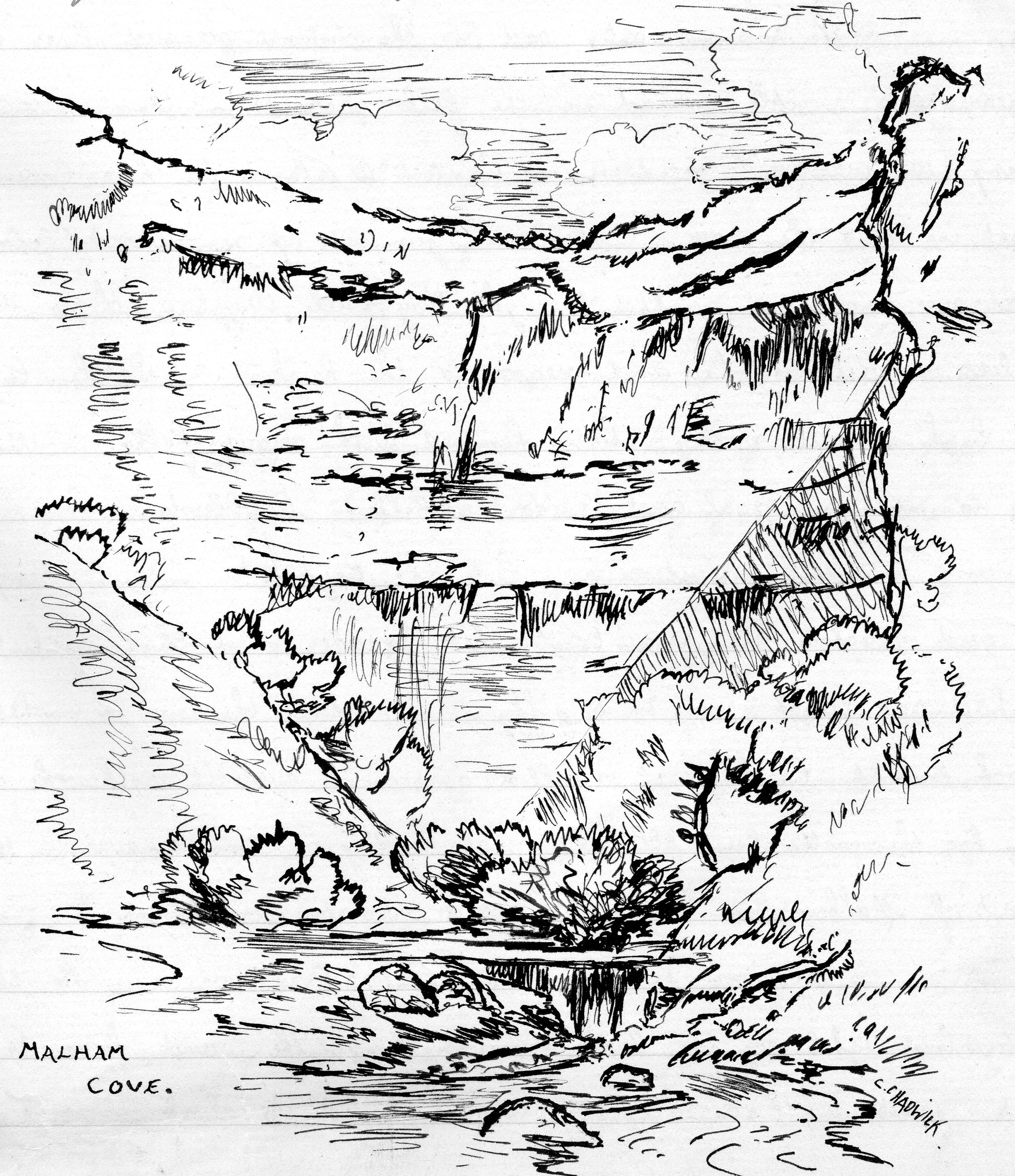
We did not go right to the Tarn, but turned for Malham, along the worst length of road I have seen this year. It was rideable – but hardly, consisting of about six inches of slime, along the surface of which, we slithered and floundered. We had about a mile and a half of it across Ewe moor, then the road dipped and shelved down in breakneck fashion. In direct opposition to its recent condition, it became stony and boulder strewn. Soon we came in sight of Malham Cove, a fine example of the Craven Fault. This magnificent cliff, in form like the segment of a circle, rises to a height of nearly 300 ft. Its summit overhangs, and yet there are green ledges from which spring full grown trees. A stream, the main branch of the River Aire, bubbles from its base up into daylight. Formerly, it is said, the stream came in one bound from the top of the cliff, and if it is so, it must have been a wonderful sight. At present it is ‘swallowed’ about a mile upstream above the Cove.
Until quite recently, it was supposed that the stream issuing from Malham Tarn, which disappears a short distance further down from the Tarn, was identical with the one that gushes forth at the foot of the Cove: but tests of various kinds lately applied, seems to prove that the Tarn outflow re-appears at Aire Head, a large spring below Malham Village, a mile from the Cove. Several days elapsed before the dyed water dropped into the stream issuing from the Tarn found its way out at Aire Head – a fact which points to the possibility of an underground lake. The district teems with interest, both geological and for the sightseer.
A headlong rush downhill brought us to Malham, a pleasant, irregular place, with the stream that issues from the Cove flowing through it. The road henceforth through Kirkby Malham to Airton was pleasant and very undulating, becoming hillier still when we left Airedale and turned towards Hellifield.. On this road we got a last glimpse of snowy, limestone ridges, then we increased speed to the railway junction and community of Hellifield. Hellifield had nothing to detain us, and so we hurried out of it, crossing Ribblesdale, and joining the Bolton by Bowland road. The sun came out, and the stony road developed into a hard climb through the Forest of Bowland, a moorland with only occasional signs of ‘forest’. Two miles later we started dropping downhill, and for over two miles our progress was swift and easy, running into a beautifully wooded district, then across the bridge into the charming village of Bolton by Bowland, a place rich in folk-lore and song. A little beyond here we joined the Wigglesworth-Sawley road, the same that we had traversed this morning, and shortly reached the River Ribble at Sawley again. This time we kept to the other side of the river, in pleasant byways to Grindleton, then Waddington with its flowery almshouses. We stopped in the ancient village street, down the middle of which a large stream runs, to view Waddington Hall, supposed to be an exact replica of a very old Hall, historically interesting, which was burned down years ago. Then downhill to the Ribble at Roefield, and so into Clitheroe once more.
We were getting hungry, and that four petrolised miles to Whalley were covered rapidly, then the climb up the bank, and we headed for Copster Green. ‘Mary’ had gone out of business, so we had to carry on to Mellor Brook where I knew of a good place. We were hungry and after a wash, we settled down to shift something. P.A. of the Bolton Wheelers was in the café, and he proved very interesting company.
It was a grand night, when we started on the return journey, climbing up to Cherry Tree, then taking the bylanes, and the Tockholes road with lamps lit. It is a hilly, rough, winding road, and in consequence we were delayed, reaching Belmont at 8.30pm. Dropping to Bolton, I left Tom on Orlando Bridge, then made my way home. Today has been superb, and something new for both of us, our decision being that we must have more of it. Another Century! 108 miles
Will you go with me to the moors?
To the land of grouse and heather –
Yon level ridge in the distance,
Where hill and sky meet together?
One hour from where we are standing,
In sound of the forge and hammer,
And you’ll hear the crow of the Moorcock,
And the lapwing’s ceaseless clamour.
J.H.J.